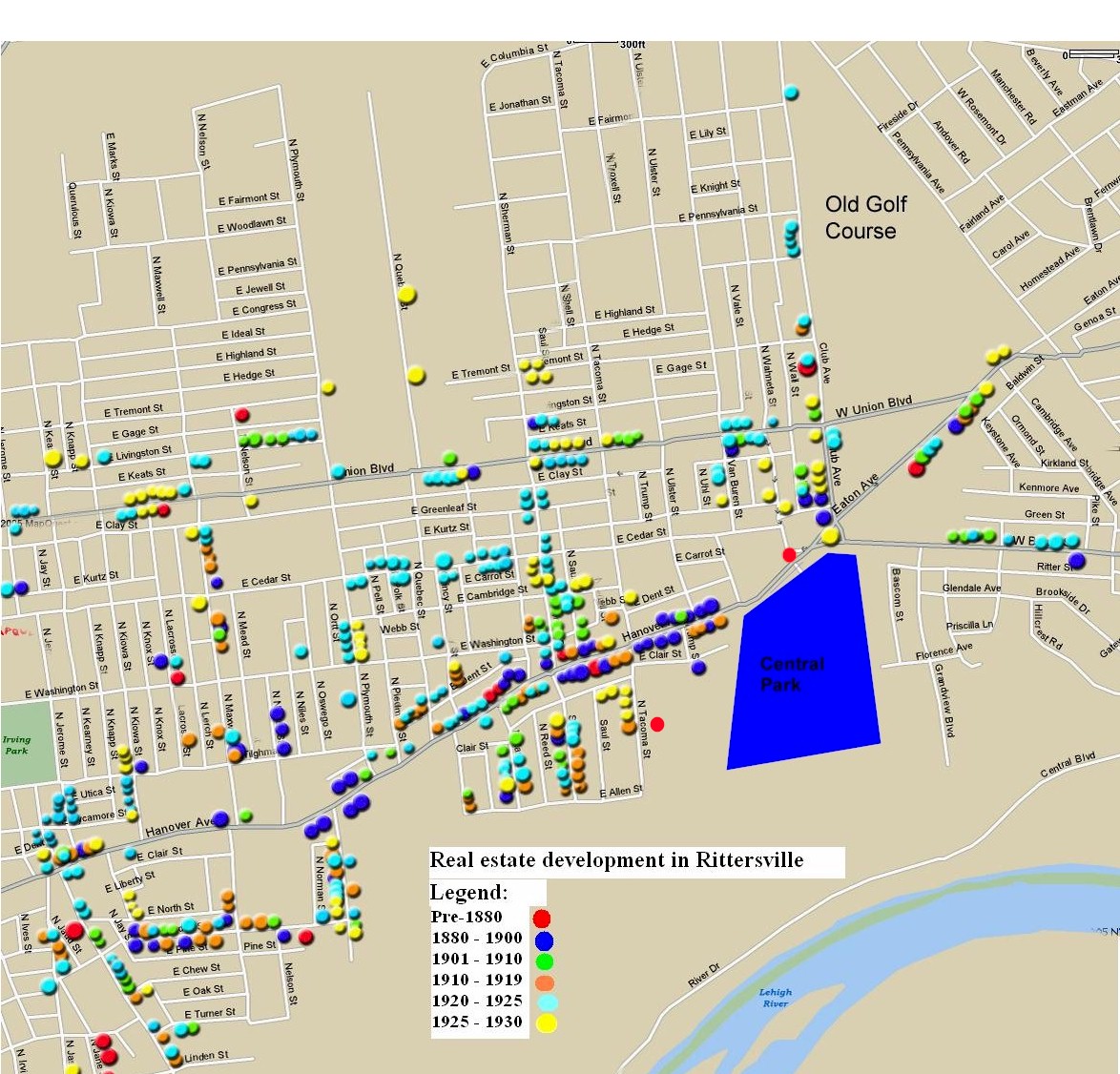
A word about the map: The plots shown on the map were compiled from the Lehigh County assessment records, which show when the house was built. What the map does not reflect are many of the older homes, particularly from the 1800's. That is because many of them were torn down and new houses built on the lots.
The individual markers do not necessarily reflect a single house. They are more representative of when an area was developed. The dots can represent houses, rows of houses or neighborhoods.